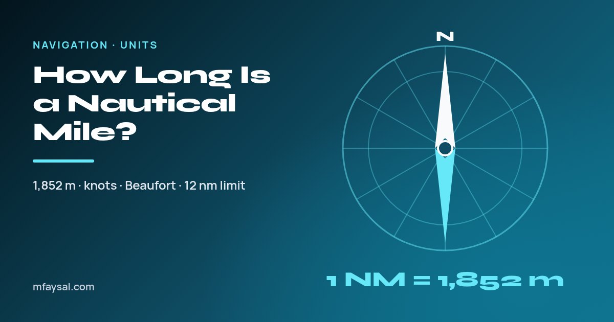
A nautical mile is exactly 1,852 metres, which is about 1.15 ordinary (statute) miles, 1.852 kilometres or 6,076 feet. It's longer than a land mile because it was designed to match one minute of latitude on the Earth's surface, which makes distances easy to read off a chart. A knot, the unit of speed at sea and in the air, is one nautical mile per hour.
If you've ever wondered why a ferry timetable, a sailing app or the radio shipping forecast talks in nautical miles while the road signs outside say miles, you're not alone. The two units share a name, but they were built for completely different jobs.
This guide explains where the 1,852-metre figure comes from, how it compares with miles and kilometres, how knots and the Beaufort scale fit in, and where nautical miles show up in UK and US life, from territorial waters to weather forecasts. To convert a figure straight away, use the metres to nautical miles converter.
In this guide:
- Nautical mile vs mile vs kilometre at a glance
- Why a nautical mile is based on latitude
- Where the 1,852-metre definition came from
- Nautical miles to kilometres and miles: conversion chart
- Knots: speed in nautical miles per hour
- Nautical miles in the UK shipping forecast
- The Beaufort scale in knots
- 12, 24 and 200: nautical miles in maritime law
- Quick mental maths for nautical miles
- Common mistakes with nautical miles
- Frequently asked questions
Nautical mile vs mile vs kilometre at a glance
Here's how one nautical mile compares with the units people use on land. The metre value is exact by definition; the others are rounded.
| Unit | One nautical mile equals | One of these equals |
|---|
| Metres | 1,852 m (exact) | 0.00054 nautical miles |
| Kilometres | 1.852 km | 0.54 nautical miles |
| Statute (land) miles | 1.1508 miles | 0.869 nautical miles |
| Feet | 6,076.1 ft | 0.000165 nautical miles |
| Yards | 2,025.4 yd | 0.000494 nautical miles |
The statute mile used on UK and US roads is 1,760 yards, and since a yard is exactly 0.9144 metres, a land mile is exactly 1,609.344 metres. Divide 1,852 by 1,609.344 and you get the 1.1508 ratio.
So a nautical mile is roughly 15% longer than a land mile. That gap matters more than it sounds: a 100-nautical-mile crossing is about 115 land miles, not 100.
Why a nautical mile is based on latitude
Navigators work with latitude and longitude. A full circle is 360 degrees, and each degree splits into 60 minutes of arc. The nautical mile was meant to be the distance along the Earth's surface that matches one minute of latitude.
That makes chart work wonderfully simple. Most nautical charts have a latitude scale up the side, and because each minute on that scale is roughly one nautical mile, a navigator can measure a distance with dividers and read it straight off the edge of the chart. No separate scale bar, no conversion.
There's a catch, though. The Earth isn't a perfect sphere; it's slightly flattened at the poles. So the real length of one minute of latitude changes a little as you move north or south. Using the WGS 84 ellipsoid that GPS relies on, it works out at roughly:
| Latitude | Example place | Length of one minute of latitude |
|---|
| 0° | The equator | about 1,843 m |
| 45° | Bordeaux, Minneapolis | about 1,852 m |
| 51.5° | London | about 1,854 m |
| 60° | Shetland | about 1,857 m |
| 90° | The poles | about 1,862 m |
A unit that changes length depending on where you stand is no good for law, engineering or international agreements. That's why the modern nautical mile is a fixed number of metres, chosen to sit close to the average minute of latitude, while sailors still enjoy the "one minute is about one mile" shortcut.
One more nice coincidence: the metre was originally conceived as one ten-millionth of the distance from the North Pole to the equator. That quarter of a meridian is 90 × 60 = 5,400 minutes of latitude, and 10,000 km divided by 5,400 is 1,851.85 metres. Round it and you have 1,852.
Where the 1,852-metre definition came from
Before the twentieth century, countries used slightly different nautical miles, each based on their own choice of Earth model or latitude. That was fine for local charts but awkward for international shipping.
According to Geoscience Australia, the value of 1,852 metres was adopted by the International Hydrographic Conference in 1929 and has since been adopted by the International Bureau of Weights and Measures. Geoscience Australia abbreviates it as M, while you'll see NM, nmi or nm in aviation, apps and everyday writing.
Not every country switched straight away. NOAA notes that the US and the UK kept slightly different measurements after 1929. The US adopted the international nautical mile in 1954 and the UK followed in 1970. So if you ever read old British Admiralty material or pre-1970 sailing books, the "nautical mile" in them may differ slightly from today's.
For anything current (charts, GPS units, legislation, aviation), the answer is always the international nautical mile of exactly 1,852 metres. UK law even spells this out, as you'll see in the section on territorial waters below.
Nautical miles to kilometres and miles: conversion chart
Use these values for quick reference. Kilometres are exact multiples of 1.852; miles are rounded to two decimal places.
| Nautical miles | Kilometres | Statute miles |
|---|
| 1 | 1.852 | 1.15 |
| 2 | 3.704 | 2.30 |
| 3 | 5.556 | 3.45 |
| 5 | 9.26 | 5.75 |
| 10 | 18.52 | 11.51 |
| 12 | 22.224 | 13.81 |
| 24 | 44.448 | 27.62 |
| 50 | 92.6 | 57.54 |
| 100 | 185.2 | 115.08 |
| 200 | 370.4 | 230.16 |
| 1,000 | 1,852 | 1,150.78 |
The formulas are simple:
- Nautical miles to km: multiply by 1.852.
- Km to nautical miles: divide by 1.852 (or multiply by about 0.54).
- Nautical miles to statute miles: multiply by 1.1508.
- Statute miles to nautical miles: multiply by 0.869.
For feet, yards, inches or anything else, the length converter uses the same exact factors and includes nautical miles alongside metric and imperial units.
Knots: speed in nautical miles per hour
A knot is one nautical mile per hour. That's all it is, which is why "knots per hour" is a mistake: it would mean acceleration, not speed.
The name has a lovely origin. NOAA's Ocean Service explains that in the 17th century sailors measured speed with a "common log": a rope with knots tied at regular intervals, attached to a wedge of wood. They let the wood float behind the ship for a set time, often timed with a sandglass, and then counted how many knots had run out.
| Knots | mph | km/h | m/s |
|---|
| 1 | 1.15 | 1.85 | 0.51 |
| 10 | 11.5 | 18.5 | 5.1 |
| 20 | 23.0 | 37.0 | 10.3 |
| 30 | 34.5 | 55.6 | 15.4 |
| 34 (gale threshold) | 39.1 | 63.0 | 17.5 |
| 64 (hurricane force) | 73.7 | 118.5 | 32.9 |
Distance, speed and time work exactly as they do on land. A boat making 15 knots for 4 hours covers 60 nautical miles, which is about 69 statute miles. Because charts are measured in nautical miles and boat speeds are in knots, sailors almost never need to convert at all, which is the whole point of the system.
NOAA also notes that air and space travel use latitude and longitude for navigation, and nautical miles for distance, which is why aircraft speeds and wind speeds in aviation forecasts are given in knots too.
Nautical miles in the UK shipping forecast
If you've ever listened to the BBC Radio 4 shipping forecast, you've heard nautical miles and knots in action. The Met Office uses precise, defined terms so that a few words carry an exact meaning.
The Met Office marine forecasts glossary defines visibility like this:
| Forecast term | Visibility | Roughly in land miles |
|---|
| Very poor | Less than 1,000 metres | under 0.6 miles |
| Poor | 1,000 metres to 2 nautical miles | 0.6 to 2.3 miles |
| Moderate | 2 to 5 nautical miles | 2.3 to 5.8 miles |
| Good | More than 5 nautical miles | over 5.8 miles |
The same glossary defines how fast weather systems move, in knots: "slowly" means under 15 knots, "steadily" 15 to 25, "rather quickly" 25 to 35, "rapidly" 35 to 45 and "very rapidly" more than 45 knots.
Gale warnings are defined in knots too. A gale is Beaufort force 8, which the glossary gives as winds of 34 to 40 knots or gusts of 43 to 51 knots. So when you hear "gale 8, occasionally severe gale 9", you know the forecaster means sustained winds of roughly 34 to 47 knots, about 39 to 54 mph.
The Beaufort scale in knots
The Beaufort scale describes wind strength by its effect on the sea. The Met Office's Beaufort scale guide gives the speed limits for each force in knots, and says that to convert knots to mph you multiply by 1.15, or by 0.514 for metres per second.
| Force | Description | Wind speed (knots) | Approx. mph |
|---|
| 0 | Calm | less than 1 | less than 1 |
| 1 | Light air | 1 to 3 | 1 to 3 |
| 2 | Light breeze | 4 to 6 | 5 to 7 |
| 3 | Gentle breeze | 7 to 10 | 8 to 12 |
| 4 | Moderate breeze | 11 to 16 | 13 to 18 |
| 5 | Fresh breeze | 17 to 21 | 20 to 24 |
| 6 | Strong breeze | 22 to 27 | 25 to 31 |
| 7 | Near gale | 28 to 33 | 32 to 38 |
| 8 | Gale | 34 to 40 | 39 to 46 |
| 9 | Strong gale (Met Office: severe gale) | 41 to 47 | 47 to 54 |
| 10 | Storm | 48 to 55 | 55 to 63 |
| 11 | Violent storm | 56 to 63 | 64 to 72 |
| 12 | Hurricane force | 64 or more | 74 or more |
The mph column is converted with the exact factor (1.1508) and rounded, so it can differ by a mile per hour or so from charts that use 1.15. For planning a day on the water, the knots column is the one to trust, because that's what the forecast actually says.
12, 24 and 200: nautical miles in maritime law
Nautical miles aren't just for sailors. They also mark out where a country's laws apply at sea.
In the UK, section 1 of the Territorial Sea Act 1987 sets the breadth of the territorial sea adjacent to the United Kingdom at 12 nautical miles, and the same section defines "nautical miles" as "international nautical miles of 1,852 metres". The distance is measured from official baselines, which mostly follow the low-water line.
The wider pattern comes from the United Nations Convention on the Law of the Sea (UNCLOS). Geoscience Australia's summary of maritime zones, quoted earlier, describes the standard limits like this:
| Zone | Outer limit | In kilometres | In land miles |
|---|
| Territorial sea | 12 nautical miles | 22.2 km | 13.8 miles |
| Contiguous zone | 24 nautical miles | 44.4 km | 27.6 miles |
| Exclusive economic zone (EEZ) | 200 nautical miles | 370.4 km | 230.2 miles |
In the territorial sea a coastal state has sovereignty, subject to foreign ships' right of innocent passage. In the contiguous zone it can enforce customs, tax, immigration and health rules. In the EEZ it has rights over natural resources such as fish, oil, gas and offshore wind.
So when a news story says a vessel was stopped "12 miles off the coast", it almost always means 12 nautical miles, which is nearly 14 miles in road terms.
Quick mental maths for nautical miles
You don't need a calculator for most everyday conversions. These shortcuts are close enough for planning, though not for navigation:
- Nautical miles to land miles: add 15%. 40 nautical miles is about 40 + 6 = 46 miles.
- Land miles to nautical miles: take off about 13%. 100 miles is about 87 nautical miles.
- Nautical miles to km: double it and take off 7.5%. 20 nautical miles is about 40 − 3 = 37 km.
- Km to nautical miles: halve it and add a little. 50 km is about 25 + 2 = 27 nautical miles.
- Knots to mph: add 15%, just like distance. A 20-knot wind is about 23 mph.
For anything where accuracy matters, such as passage planning, fuel calculations or a homework answer, use the exact factors: 1,852 metres per nautical mile and 1.1508 statute miles per nautical mile.
Common mistakes with nautical miles
- Treating a nautical mile as a normal mile. It's about 15% longer, which adds up quickly on a long trip.
- Saying "knots per hour". A knot already means per hour.
- Using the longitude scale to measure distance. Lines of longitude get closer together towards the poles, so a minute of longitude shrinks as you go north. On a chart, always measure distance against the latitude scale at the side, at roughly the same latitude as your route.
- Mixing up abbreviations. "nm" can also mean nanometre. In technical writing, NM, nmi or M avoid the confusion.
- Assuming old documents use 1,852 m. Older British and American sources may use the pre-1970 and pre-1954 national values.
- Forgetting the baseline. Territorial limits are measured from official baselines, not from the beach at high tide.
Frequently asked questions
How long is a nautical mile in metres?
A nautical mile is exactly 1,852 metres. This international definition was adopted in 1929 and is used in the UK, the US and almost everywhere else.
How many miles is a nautical mile?
One nautical mile is about 1.1508 statute (land) miles, so it's roughly 15% longer than the miles on UK and US road signs.
How many feet are in a nautical mile?
There are about 6,076 feet in a nautical mile (6,076.1 to one decimal place), compared with 5,280 feet in a land mile.
Why is a nautical mile longer than a regular mile?
Because it's based on the Earth's geometry rather than on yards. It was designed to equal one minute of latitude, which is about 1,852 metres, while a statute mile is 1,760 yards, or 1,609.344 metres.
What is a knot?
A knot is a speed of one nautical mile per hour, about 1.15 mph or 1.85 km/h. It's used for boat speeds, aircraft speeds and wind speeds in marine and aviation forecasts.
How far is 12 nautical miles in miles?
12 nautical miles is about 13.8 statute miles, or 22.2 kilometres. It's the breadth of the UK's territorial sea under the Territorial Sea Act 1987.
Why do pilots and sailors use nautical miles?
Charts and navigation systems use latitude and longitude. Since a nautical mile is about one minute of latitude, distances can be measured straight off a chart's latitude scale, and knots line up with those distances.
Is a nautical mile the same everywhere?
Yes. Today the international nautical mile is a fixed 1,852 metres everywhere. The actual length of a minute of latitude varies slightly, from about 1,843 m at the equator to about 1,862 m at the poles, but the unit itself doesn't change.
Last checked: 20 October 2026. Figures, settings and guidance can change, so confirm anything important with the sources linked above.